


Geology Site Account
A-Z Geological Site Index
Marks Tey Brickpit SSSI, MARKS TEY , Colchester District, TL911243, Site of Special Scientific Interest
|
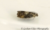
Site category: Interglacial deposit Site name: Marks Tey Brickpit SSSI Grid reference: TL 911 243 Brief description of site: Marks Tey has uniquely important Ice Age sediments, which have yielded a continuous pollen record through the entire Hoxnian Interglacial stage (400,000 years ago). No other site in the British Isles has so far produced a comparable vegetational record for this or any other interglacial. Of considerable interest also are the laminations (seasonal layers) within these lacustrine (lake) sediments which have made it possible to estimate the duration in years of the Hoxnian Interglacial. (extract from the SSSI citation) ---------------------------------------- Details Almost at the south-eastern edge of the boulder clay plateau, between Marks Tey and Copford, a steep-sided valley is cut into the bedrock. It is now filled with later sediments but has been interpreted as a sub-glacial meltwater channel. Following retreat of the ice this valley was partially blocked with sediment creating at least two lakes, one at Copford and one at Marks Tey. The clay deposited in the Marks Tey lake is now quarried at the brickworks and it provides a unique glimpse of Essex climate and vegetation some 400,000 years ago (the Hoxnian Interglacial Stage). Studies of fossil pollen contained in each clay layer have produced a continuous record of the vegetation growing in the vicinity throughout the complete interglacial cycle (approx. 25,000 years). The resulting pollen diagram, produced in 1971 by Charles Turner of Cambridge University, is famous as a classic example of palynological research. The sediments representing the warmest part of the Hoxnian interglacial are below the quarry floor. The exposures in the quarry represent the overlying colder climate lake deposits as the climate deteriorated. The quarry is large, and almost completely overgrown except for a small area excavated for brickmaking. The site contains some fine 19th century bottle kilns (Grade II listed). A fossil fish from Marks Tey, preserved in the clay, is on display in Colchesters Natural History Museum.
|
if you have an image please upload it
|

Geology Site Map
A-Z Geological Site Index